What To Do
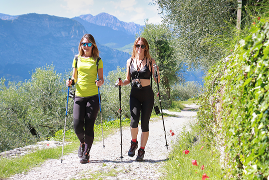
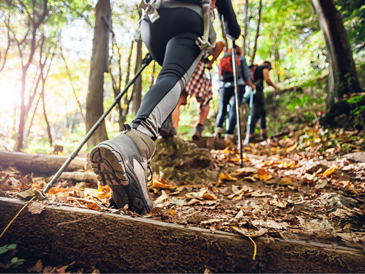
TREKKING - TREKKING TRAILS

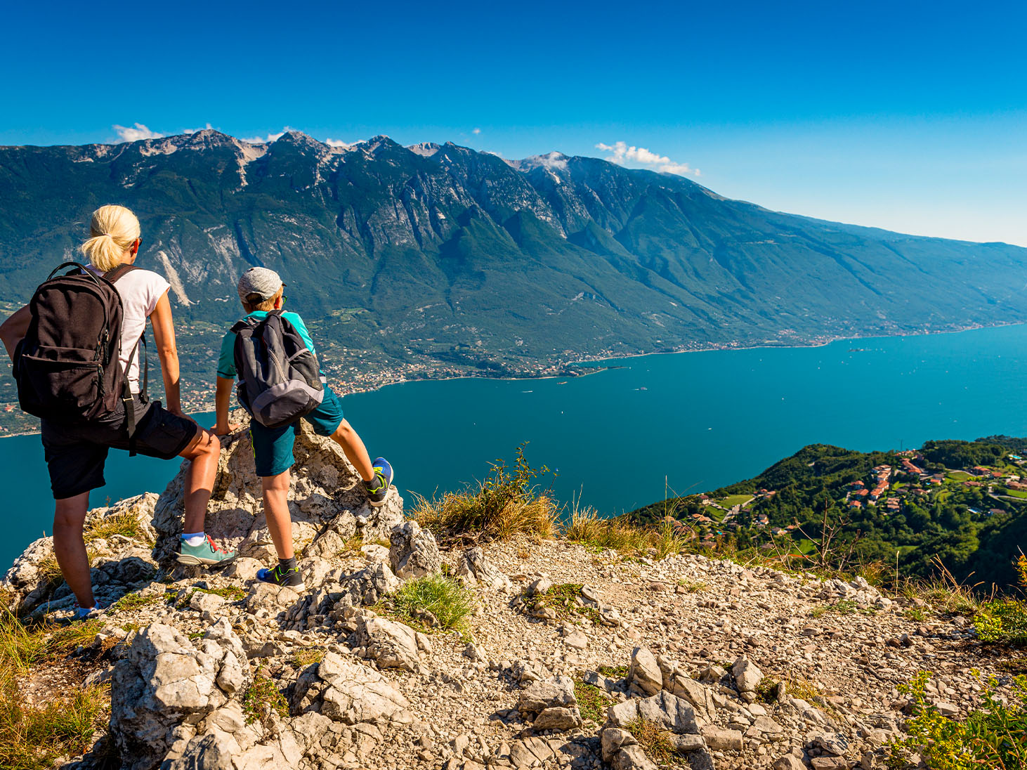
At high altitude or on the hills of Garda Veneto, you can explore the area, discover unspoilt places and unique views. From the 2,000 metres of Monte Baldo to less demanding trails, the Garda area can offer you the adventure you are looking for. The itineraries stretch for kilometres and allow you to explore unique places to be discovered with map in hand or accompanied by a mountain professional.

All the routes:
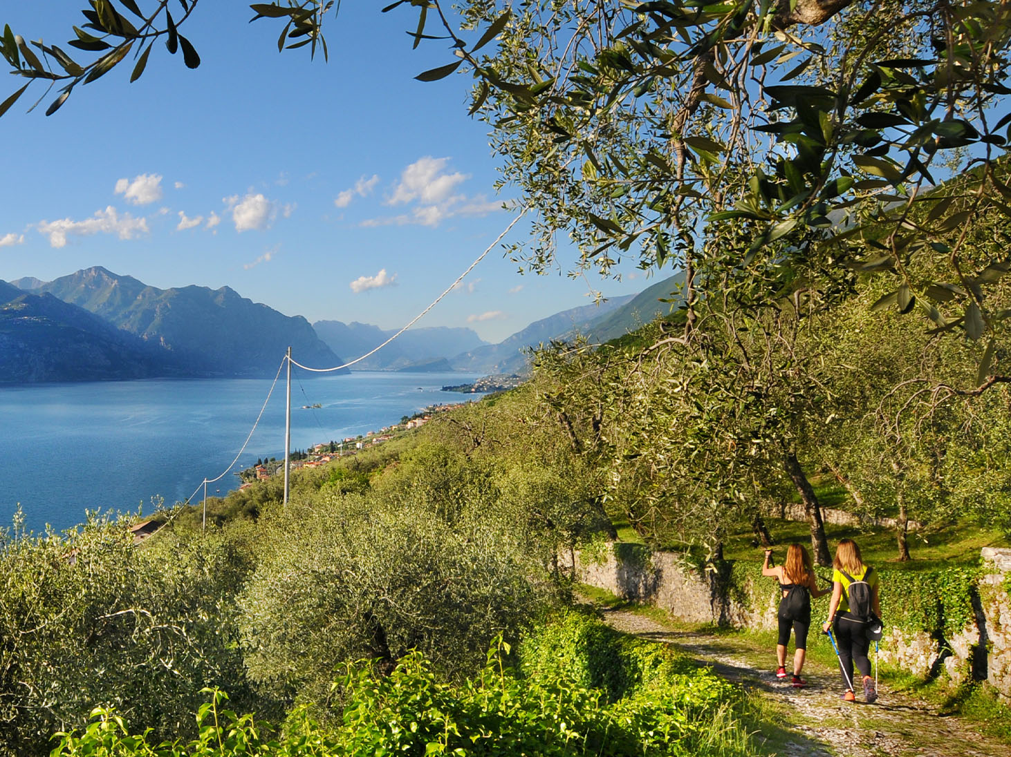
Panoramic route through towns of Brenzone sul Garda
Brenzone sul Garda
An easy circular trail of thirteen kilometres through the towns in the community of Brenzone, starting from Sommavilla and ending at Castelletto on the Lake Garda shore.
![]() Trekking Trails
Trekking Trails

Length: 13,2 km
Height difference: 550/556 m
Difficulty: Easy
Excursion to the Hermitage of San Benigno and Caro on Monte Baldo
Malcesine
A fifteen kilometre itinerary which is quite demanding but very varied and satisfying. The route starts in Malcesine on the CAI 659 path and leads to the Hermitage of San Benigno and Caro, passing through many panoramic points on the gorges and tower…
![]() Trekking Trails
Trekking Trails
Length: 8,3 km
Height difference: 1000/1002 m
Difficulty: Medium
Excursion to the hamlet of Campo da S.Antonio delle Pontare
Brenzone sul Garda
An itinerary within everyone’s reach along the mule tracks and paths of Brenzone sul Garda. Starting from Castello, climb up to S.Antonio delle Pontare, descend and climb back up to the well-known village of Campo and return to the starting point via…
![]() Trekking Trails
Trekking Trails
Length: 6 km
Height difference: 529/499 m
Difficulty: Medium-Easy
Points of interest:
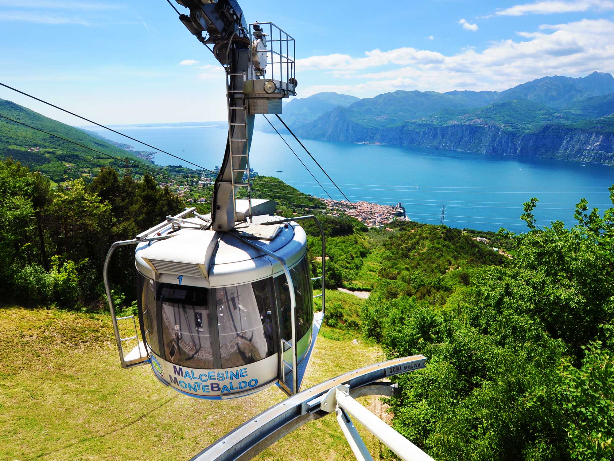
Cable car Malcesine-Monte Baldo
Malcesine
Reaching the top of Monte Baldo in twenty minutes with the Malcesine cable car is an experience that cannot be missed. Considered to be one of the mos…
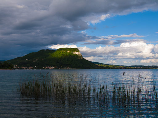
La Rocca di Garda
Garda
La Rocca is a headland that in the Middle Ages was topped by a fortress which gave its name to the entire lake, changing it from “Benaco” to “Lago di…
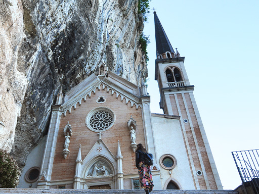
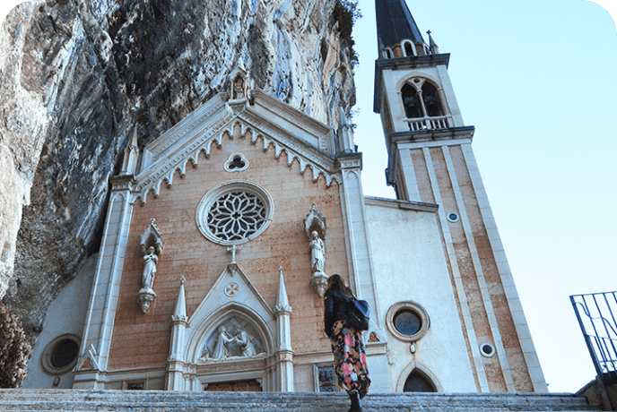
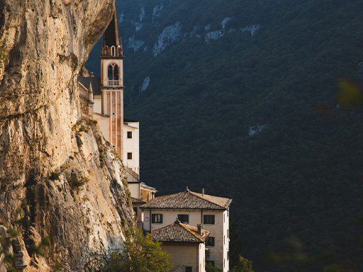
Sanctuary Madonna della Corona
Ferrara di Monte Baldo
An ideal destination for those seeking tranquillity and spirituality, the Santuario Madonna della Corona is the perfect combination of history and nat…
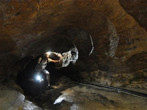
Tanella Cave
Torri del Benaco
At Pai di Sopra, on the slopes of Mount Baldo, there is a path that goes straight to the heart of the mountain, full of evocative and spectacular form…
The Path of the Madonna della Corona
Brentino Belluno
The Sentiero della Speranza (Path of Hope) consists of over 1,500 steps leading up to the Sanctuary of the Madonna della Corona, starting from the vil…
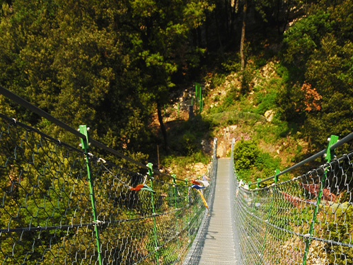
Tibetan Bridge
Torri del Benaco
The Tibetan bridge is located on the Veneto side of the lake, near Torri del Benaco, and is an ideal destination for a fun outing with children. Inaug…
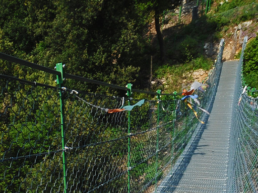
Tibetan Bridge
Brentino Belluno
The Tibetan Bridge of Brentino is an approximately 40-metre long structure made of steel ropes, set in the beautiful context of the Vajo dell’Orsa. It…
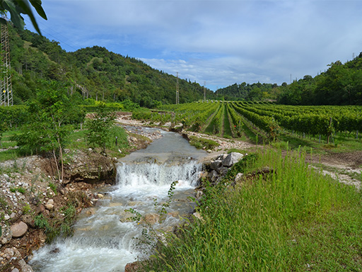
Vajo dell’Orsa
Ferrara di Monte Baldo
The Vajo dell’Orsa route begins by descending from the centre of Ferrara di Monte Baldo and taking the asphalt road no. 656. At the first hairpin bend…
Val del Tasso nature trail
Cavaion Veronese
The Val del Tasso, together with the Valsorda, introduces nature trails and accompanies visitors in a landscape that stretches from the hills to the c…
CHOOSE YOUR LAKE, LIVE A UNIQUE EXPERIENCE

On Lake Garda Veneto you can taste the flavour of the territory, discover its history and choose your vacation on the lakeside. By bike or on foot, among the vineyard and olive trees, on horseback in the moraine hills or lying on the beaches of the Riviera degli Ulivi you can live the experience you love and discover your lake.